
I love hiking although I rarely get the chance. I try to go once a month, but would love if it was a more reoccurring part of my life because maybe it wouldn’t take me a whole week to recover after one hike up Dakeng Trail.
Quick Overview of Dakeng Trail:
Dakeng is a unique and beautiful trail in Taichung City, Taiwan. There are 10 trails on the mountain. Trails 1 to 5 are more difficult, while trails 6 to 10 are more like a long relaxing stroll. We took trail 4, the most difficult due to it’s elevation and how the pathway is built. Wear comfortable shoes, and if you have sensitive hands, wear gloves since you will be using a rope to pull yourself up for most of the hike. Also bring bottles of water and a snack, it takes around 3 to 4 hours to get from bottom to peak and back. And of-course as is the case for most places in Taiwan, bring bug-spray to keep the mosquitoes away.
How to get there:
We decided to drive to the trail to save time, but beware of Google Maps which took us on a tiny dirt trail that put our car dangerously close to an edge. Always take the main road when you can.
If you’re taking the HSR from another city, we’ve used this 3-day HSR pass that gives unlimited rides there and back. Great for if you decide to hop to another city or camp out overnight.
Parking:
This is where we parked. It’s a camping ground with food, water, bathrooms, so if you decide to stay the night in your tent, you can do so here.
Starting Point:
After parking, you’ll have to walk for around 10 minutes to get to the start of the hike.
Map of Taichung City Dakeng Hiking Trails.
All trails lead to the same peak, so you can also descend down another trail if you want. You will end up at a different area to where you parked, so unless you took public transportation, would not recommend doing that.
Inscription on map: Trail 4 is 1890 meters long, has an elevation of 475 to 805 and connects with Trail 5 at the end. It is most suitable for energetic people. Zhongzheng camping ground, Zhongshi Pavilian, toilets etc are located before the trail entrance; after crossing Changqing Bridge, the entrance to the wooden plan road is reached.
The trail features a number of steep slopes. One 300 meter steep section is a test of the hiker’s strength and stamina and is known jokingly as “soft leg slope”. Due to the effect of tan earthquake, vegetation along the trail is limited. Walking up the mountain ridges is a test of hikers’ fitness and courage. There is little shade along the trail, but the view is outstanding.


The hike starts with a big elevation, ropes, and wooden ladder-like rungs that run throughout the hike. Sets expectations straight from the start.

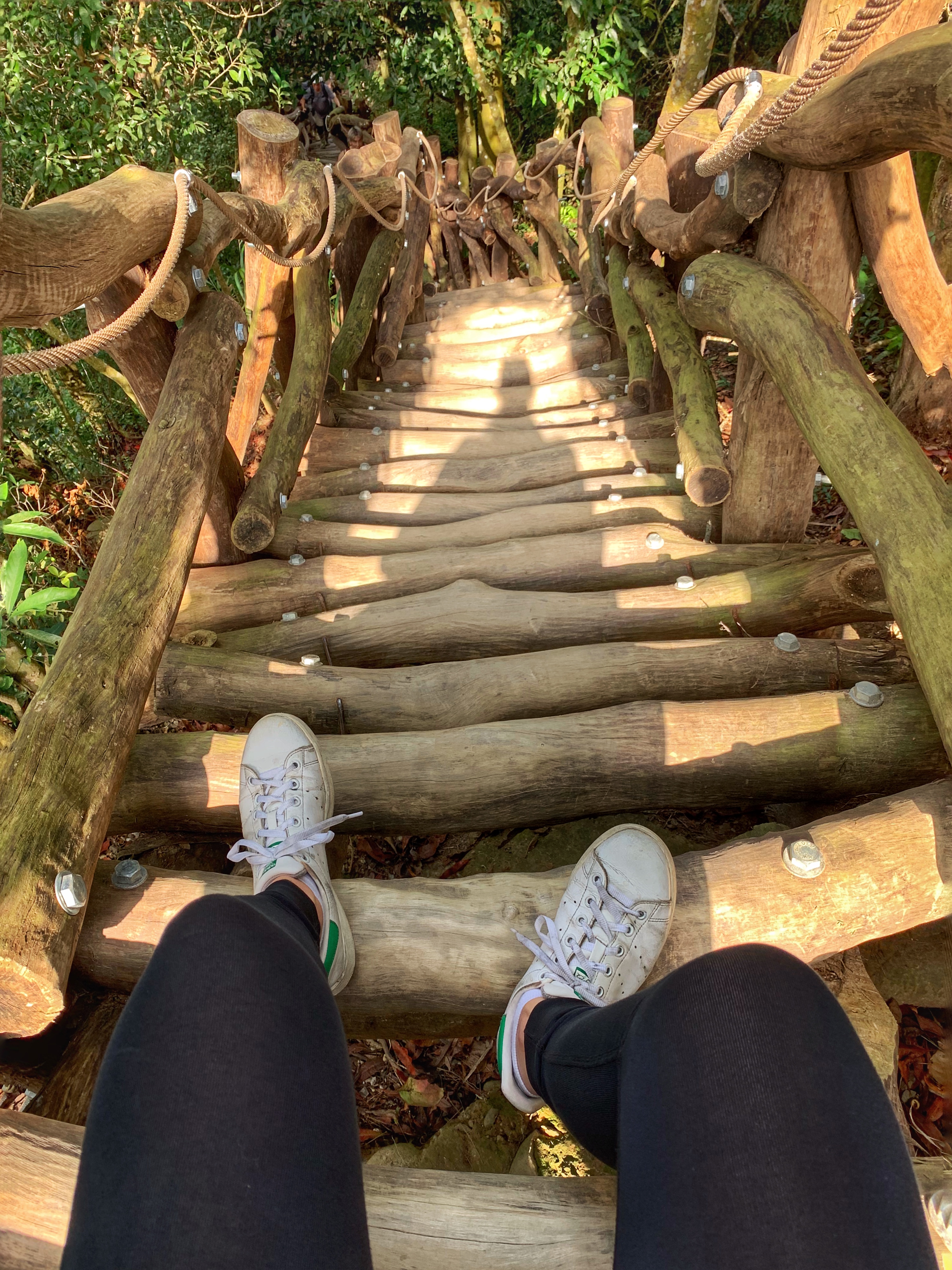
The beginning of the trail and our shoes to show the size of the logs. They do start to hurt the arch of your feet, as well as your calves, your thighs, your butt, and the rest of your entire body….

Almost at the top! We used the ropes to pull ourselves up.

Taking lots of breaks and enjoying the views.


The view of the mountains and the city in the distance. Also found some cool fungi and a hairy little caterpillar.

Another shot of the trail. It was a beautiful day, the sun giving the wood a golden glow.

Last photo op close to the top of the mountain.
The descent. I now know why it’s called soft-leg trail. Could not go any further without sitting down and resting for a few minutes. (I also slid down and cut out around 15 steps, do not recommend.)


As we were leaving we got a little treat and stumbled across a monkey family playing in the trees and eating berries and flowers. Can you spot the baby monkey?
Dakeng Trail No. 4
Difficulty: 4/5
Views: 4/5 (The views on the way to the top are better than the views at the peak)
Uniqueness: 5/5
If you’re looking for a more relaxed hike try the Butterfly Valley hike in Taichung!
If you have time, I highly recommend this tour of Taichung which includes the gorgeous Gaomei wetlands, Rainbow Village, and Miyahara.

Hiking consultation call [TEST]
Hiking consultation to help you plan your trip to Dakeng Trail. [TEST]
$100.00
Leave a Reply